Storm could bring flooding, 75 mph winds to region
Deal Lake flume opened; residents urged to sign up for Code Red alerts
Hurricane Sandy is on its way to the northeast and forecasted to bring flooding and high winds to the Asbury Park area on Monday and Tuesday, according to the National Weather Service [NWS].
Valerie Meola, a meteorologist with NWS, said the region will start to see impact from the storm on Sunday, or even as early as Saturday night, in the form of rain. Winds will pick up on Sunday evening, she said.
On Monday and Tuesday, winds are forecasted at 50 to 70 miles per hour, Meola said. Tidal flooding is expected because the full moon on those days will raise the tides. It’s still unclear how much rain will likely fall, Meola said.
Issues could arise due to trees having lost leaves and gone dormant, Meola said. This makes the ground less absorbent, and soggy leaves could clog gutters.
Hurricane Sandy will not move through the area as quickly as last September’s Hurricane Irene, Meola said.
“Irene was moving northward and hit New York City when it made landfall on the Jersey coast,” Meola said. “It looks like Sandy moves up the Delaware Bay, so it’s a different motion. We’ll have slightly different impacts from that. The wind direction will be much more on-shore in some areas.”
Because the storm is not expected to hit the area until Monday, forecasts could change, Meola said, “but preparing for the situation is not a bad idea for people. They should be prepared for the worst-case scenario.”
ASBURY PREPARES
The city’s Office of Emergency Management is headed by coordinator Terry Reidy and deputy coordinator Kevin Keddy, who is also the city’s fire and EMS [emergency medical services] chief.
“We’re expecting high winds, we’re expecting flooding,” Keddy said. “We’re currently lowering the level of Deal Lake.”
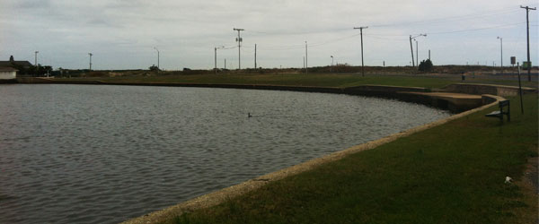
City workers have opened the lake’s flume so it is emptying into the ocean, Keddy said. Sunset Lake also drains into Deal Lake [pictured above]. By this morning, Deal Lake had already dropped by about a foot, Keddy said.
If evacuation is required, the best scenario is for residents to drive to the home of a friend or family member who is not in a high-risk area, Keddy said. If that is not possible, evacuation centers will be open at Thurgood Marshall Elementary School, as well as at county-designated places. Those staying in shelters should bring a sleeping bag, blanket or pillows, as well as medications.
There will also be shelters designated for pets, although that has not yet been determined by the county, Keddy said.
If the storm stays on its current track, the city may issue a mandatory evacuation, Keddy said. To keep abreast of developments in the city, Keddy said residents can check the Asbury Park Fire Department’s Twitter account, the city website, and the local news media.
Keddy urges city residents to register for the Code Red system, which can be done by clicking here. The system notifies residents of emergency situations.


